


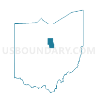
MIFFLIN TOWNSHIP D, Richland County, Ohio
About
Outline

Summary
| Unique Area Identifier | 651276 |
| Name | MIFFLIN TOWNSHIP D |
| County | Richland County |
| State | Ohio |
| Area (square miles) | 0.86 |
| Land Area (square miles) | 0.86 |
| Water Area (square miles) | 0.00 |
| % of Land Area | 99.56 |
| % of Water Area | 0.44 |
| Latitude of the Internal Point | 40.76936660 |
| Longtitude of the Internal Point | -82.43644450 |
Maps


Graphs
Select a template below for downloading or customizing gragh for MIFFLIN TOWNSHIP D, Richland County, Ohio


Neighbors
Neighoring Voting District (by Name) Neighboring Voting District on the Map
- MIFFLIN TOWNSHIP C, Richland County, OH
- MIFFLIN TOWNSHIP E, Richland County, OH
- MIFFLIN TOWNSHIP F, Richland County, OH